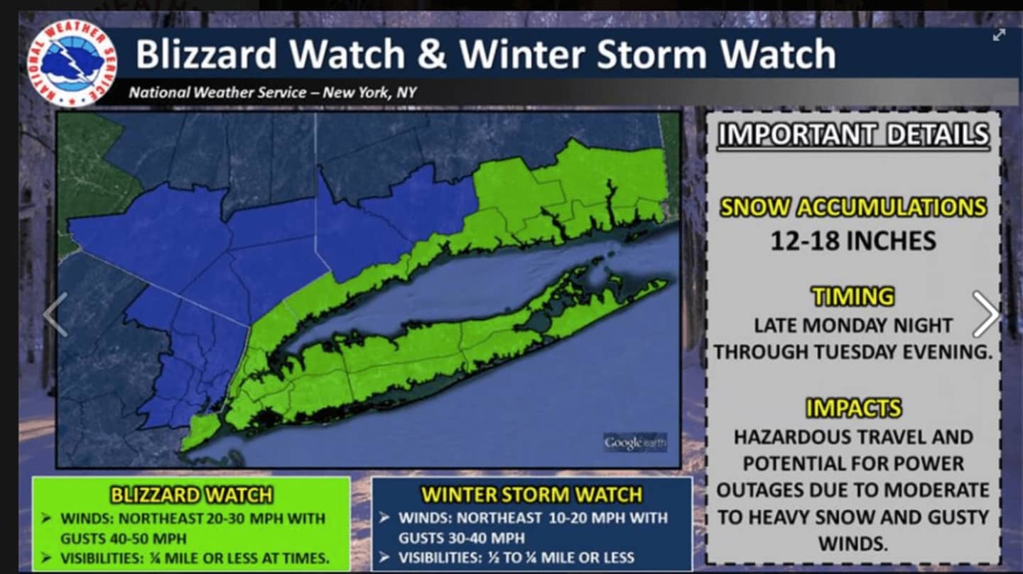
Bergen and Passaic counties is facing between 12 and 18 inches of snow with temperatures in the mid 20s.
The National Weather Service had said in a Hazardous Weather Statement issued earlier Saturday that the "potential is increasing" that the storm will bring "significant snowfall and strong winds" to the area late Monday night into late Tuesday night, with some snow continuing into Wednesday morning.
Unlike most of this winter, the storm will have access to plenty of cold air and will follow some of the coldest weather of the winter in the Northeast this weekend, AccuWeather said.
Disruptions to travel and daily activities may develop Tuesday and Tuesday night and last into Wednesday.
The storm will be a relatively fast-moving system that will be preceded by bitterly cold days Sunday and Monday.
Click here to follow Daily Voice Hackensack and receive free news updates.